Placeholder Content Image

2021 was one of the hottest years on record – and it could also be the coldest we’ll ever see again

<p>Well, it’s official: 2021 was one of the planet’s seven hottest years since records began, the World Meteorological Organization (WMO) declared this week. The year was about 1.11℃ above pre-industrial levels – the seventh year in a row that the average global temperature rise edged over 1℃.</p> <p>The WMO report echoes <a href="https://www.noaa.gov/news/2021-was-worlds-6th-warmest-year-on-record">two separate</a> <a href="https://www.nasa.gov/press-release/2021-tied-for-6th-warmest-year-in-continued-trend-nasa-analysis-shows">official US analyses</a> released last week that found 2021 was the sixth hottest year on record, tied with 2018.</p> <p>For many of us in Australia and overseas, however, 2021 may have felt generally colder and rainier than usual. This is because of the effect of back-to-back La Niña events, a natural phenomenon that brings cooler, rainier weather in our region.</p> <p>The fact 2021 was among the world’s hottest years despite these cooling forces shows just how strong the long-term warming trend is. Indeed, 2021 may well be the coldest year we’ll ever experience again. Let’s reflect on the year that was, and what we can expect for this year and beyond.</p> <p><iframe width="440" height="260" src="https://www.youtube.com/embed/PiR6TnAx36E?wmode=transparent&amp;start=0" frameborder="0" allowfullscreen=""></iframe> <span class="caption">2021 was one of the seven warmest years on record, WMO consolidated data shows.</span></p> <h2>La Niña dampens the heat, but not enough</h2> <p>2021 started and ended with La Niña events. While it’s unusual for this climate phenomenon to occur two years in a row, <a href="https://theconversation.com/back-so-soon-la-nina-heres-why-were-copping-two-soggy-summers-in-a-row-173684">it’s not unheard of</a>.</p> <p>In La Niña years, we see the global average temperature decrease by about 0.1-0.2℃. So how does it work?</p> <p>During La Niña we see cool water from deep in the Pacific Ocean rise to the surface. This happens when wind strength increases at the equator, which pushes warmer water to the west and allows more cool water to rise off the coast of South America.</p> <p>Essentially, the net transfer of energy from the surface to the deeper ocean brings the average global surface temperature down. While La Niña is a natural phenomenon (it’s not the result of human activities), human-caused climate change remains a constant underlying influence that sets a long-term warming trend.</p> <p><a href="https://images.theconversation.com/files/437382/original/file-20211213-25-9bnwpl.jpg?ixlib=rb-1.1.0&amp;q=45&amp;auto=format&amp;w=1000&amp;fit=clip"><img src="https://images.theconversation.com/files/437382/original/file-20211213-25-9bnwpl.jpg?ixlib=rb-1.1.0&amp;q=45&amp;auto=format&amp;w=754&amp;fit=clip" alt="" /></a> <span class="caption">A schematic showing interactions between the atmosphere and ocean during a La Niña.</span> <span class="attribution"><span class="source">Bureau of Meteorology.</span></span></p> <p>The La Niña conditions of 2021 took the edge off the global average surface temperature. Parts of Australia, southern Africa and northwestern North America saw cooler temperatures during 2021 compared to recent years as the effects of La Niña kicked in.</p> <p>Unless we have another strong La Niña very soon, we’re going to keep seeing even hotter years than 2021 for the foreseeable future until net global greenhouse gas emissions cease.</p> <h2>A year with massive, extreme events</h2> <p>As the world warms we’re becoming more accustomed to extreme events, especially severe heatwaves. This was no different for 2021, which was characterised one incredibly extreme heat event in particular, which occurred in western North America.</p> 
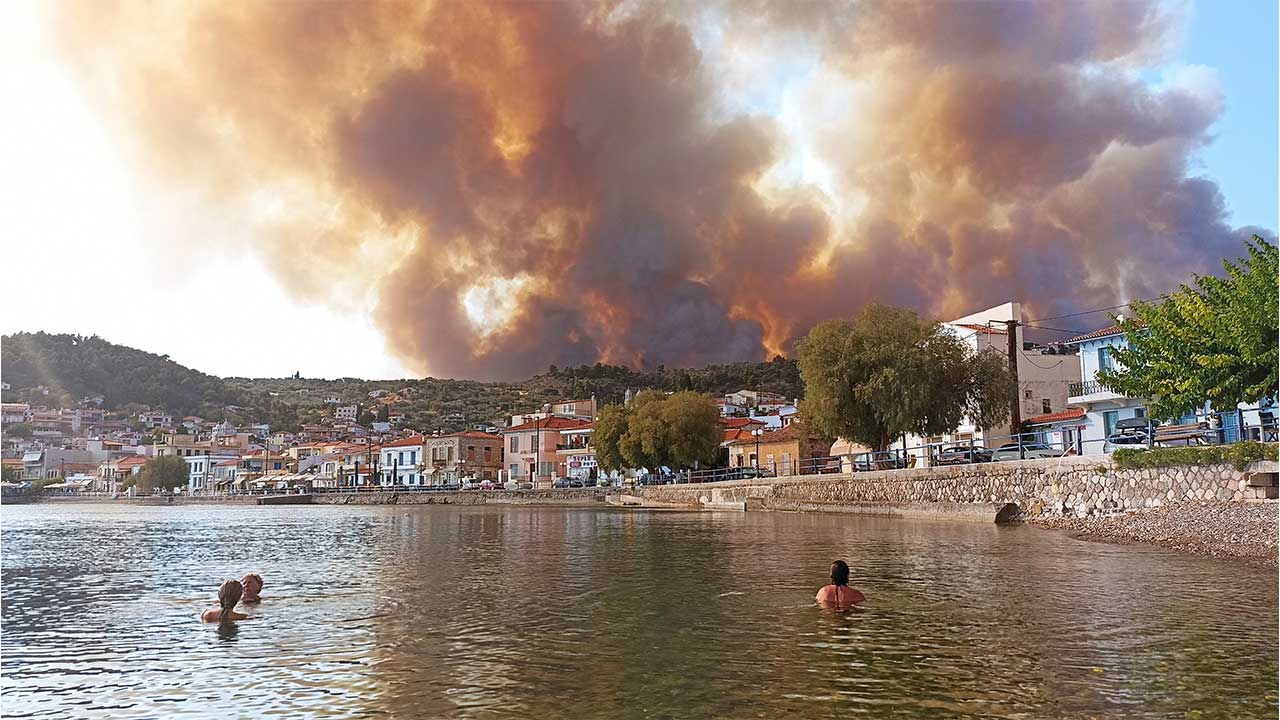
<p>In late June and early July, heat built over northwest United States and southwest Canada. <a href="https://theconversation.com/extreme-heat-waves-in-a-warming-world-dont-just-break-records-they-shatter-them-164919">New temperature records were set across the region</a> – at some sites, by several degrees. A staggering 49.6℃ was recorded in Lytton, British Columbia, which is Canada’s highest temperature measurement.</p> <p>This heatwave was disastrous, including in Seattle and Portland where <a href="https://www.nytimes.com/interactive/2021/08/11/climate/deaths-pacific-northwest-heat-wave.html">death rates spiked</a>. Soon after, <a href="https://www.abc.net.au/news/2021-07-02/lytton-fire-record-temperatures-heat-dome-canada-heatwave/100261768">wildfire destroyed</a> the town of Lytton.</p> <p>While many other parts of the world also saw heatwaves, including significant events in Europe and Asia, the western North American heatwave stands out. The scale of this event would have been <a href="https://www.worldweatherattribution.org/western-north-american-extreme-heat-virtually-impossible-without-human-caused-climate-change/">virtually impossible without human-caused climate change</a>.</p> <p>Severe floods were also a feature of 2021 in many places. Short bursts of extreme rainfall that bring flash flooding are becoming more frequent and intense due to the human influence on the climate. We saw especially devastating events in <a href="https://www.science.org/content/article/europe-s-deadly-floods-leave-scientists-stunned">central Europe</a> and in <a href="https://www.bbc.com/news/world-asia-china-57861067">China</a> in July.</p> 
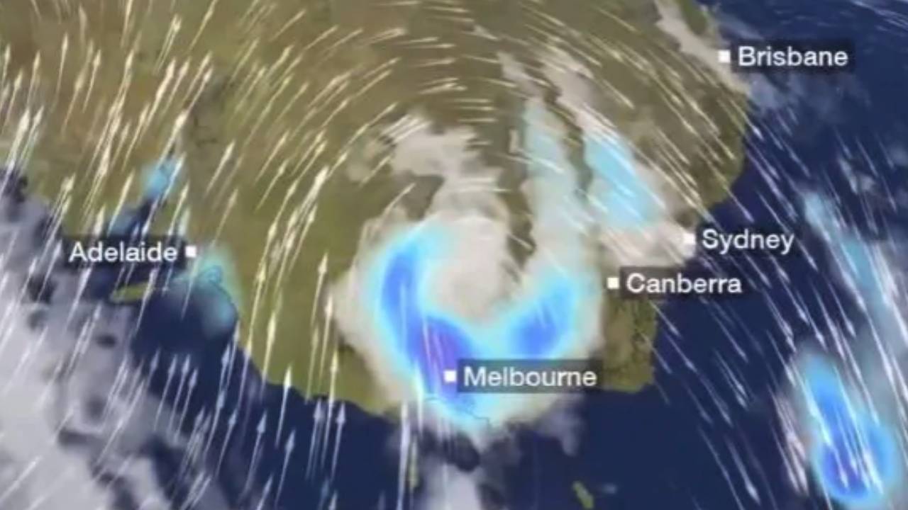
<h2>Australia’s coolest year since 2012</h2> <p>Australia not only experienced <a href="https://theconversation.com/back-so-soon-la-nina-heres-why-were-copping-two-soggy-summers-in-a-row-173684">back-to-back La Niña events</a>, but also the <a href="https://theconversation.com/a-wet-winter-a-soggy-spring-what-is-the-negative-indian-ocean-dipole-and-why-is-it-so-important-164957">negative Indian Ocean Dipole</a> – a bit like the Indian Ocean’s version of La Niña, bringing cool, rainier weather to Australia during winter and spring.</p> <p>Both left their mark, with Australia experiencing its <a href="http://www.bom.gov.au/climate/change/#tabs=Tracker&amp;tracker=timeseries">coolest year since 2012</a> and its <a href="http://www.bom.gov.au/climate/change/#tabs=Tracker&amp;tracker=timeseries&amp;tQ=graph%3Drranom%26area%3Daus%26season%3D0112%26ave_yr%3D0">wettest year since 2016</a>.</p> <p>And still, 2021 was warmer than any year in the observational series prior to 1980. In fact, Australia is warming faster than the world as a whole, with <a href="https://theconversation.com/climate-change-has-already-hit-australia-unless-we-act-now-a-hotter-drier-and-more-dangerous-future-awaits-ipcc-warns-165396">Australian temperatures</a> already up <a href="http://www.bom.gov.au/state-of-the-climate/australias-changing-climate.shtml">about 1.4℃ since 1910</a>.</p> <p>We also saw major floods in Australia that inundated <a href="https://www.abc.net.au/news/2021-04-20/nsw-floods-break-120-year-old-rain-records/100079400">eastern New South Wales</a> in March, and <a href="https://www.theguardian.com/australia-news/2021/dec/01/queensland-floods-950-evacuated-from-inglewood-as-rising-rivers-threaten-towns">Queensland</a> more recently.</p> <p>However, the influence of climate change on extreme rainfall in Australia is less clear than for other parts of the world because Australia has a high climate variability - swinging from drought to flooding rains and back again. Another reason is because our major floods are often caused by extreme rain that falls for several days, and the effect of climate change on this type of rain is difficult to unpick.</p> <h2>What’s in store for 2022 and beyond</h2> <p>We can’t forecast the weather beyond about ten days, but we can make a couple of forecasts for 2022 with confidence.</p> <p>First, while 2022 may experience a slight cooling influence from <a href="http://www.bom.gov.au/climate/enso/outlook/">the ongoing La Niña</a>, it will still be among our warmest years. To have an individual year as cool as those we experienced as recently as the 1990s is exceptionally unlikely due to our high greenhouse gas emissions.</p> <p>Second, there will be more extreme heat events somewhere on Earth this year, because our influence on the climate has <a href="https://theconversation.com/why-hot-weather-records-continue-to-tumble-worldwide-86158">greatly increased the odds of record-breaking heatwaves occurring</a>.</p> <p>Even if we start acting on climate change with more urgency, we will experience more frequent and intense heatwaves in coming years. This means we need to <a href="https://theconversation.com/adapting-cities-to-a-hotter-world-3-essential-reads-120634">build greater resilience to these extremes</a> and adapt cities and towns to a hotter world.</p> <p>Beyond 2022, we know we will see continued global warming until we stop emitting greenhouse gases into the atmosphere. And with global carbon dioxide emissions rebounding to <a href="https://www.globalcarbonproject.org/carbonbudget/21/highlights.htm">near-record levels in 2021</a> after a brief drop in 2020 from the pandemic, we’re a long way off stopping global warming.</p> <p>Rapid decarbonisation is needed to reduce further warming of the planet. It’s not too late to <a href="https://theconversation.com/theres-no-end-to-the-damage-humans-can-wreak-on-the-climate-this-is-how-bad-its-likely-to-get-166031">avoid the most dangerous climate change impacts</a>. <!-- Below is The Conversation's page counter tag. Please DO NOT REMOVE. --><img style="border: none !important; box-shadow: none !important; margin: 0 !important; max-height: 1px !important; max-width: 1px !important; min-height: 1px !important; min-width: 1px !important; opacity: 0 !important; outline: none !important; padding: 0 !important; text-shadow: none !important;" src="https://counter.theconversation.com/content/175238/count.gif?distributor=republish-lightbox-basic" alt="The Conversation" width="1" height="1" /><!-- End of code. If you don't see any code above, please get new code from the Advanced tab after you click the republish button. The page counter does not collect any personal data. More info: https://theconversation.com/republishing-guidelines --></p> <p><span><a href="https://theconversation.com/profiles/andrew-king-103126">Andrew King</a>, Senior Lecturer in Climate Science, <em><a href="https://theconversation.com/institutions/the-university-of-melbourne-722">The University of Melbourne</a></em></span></p> <p>This article is republished from <a href="https://theconversation.com">The Conversation</a> under a Creative Commons license. Read the <a href="https://theconversation.com/2021-was-one-of-the-hottest-years-on-record-and-it-could-also-be-the-coldest-well-ever-see-again-175238">original article</a>.</p> <p><em>Image: AP Photo/Michael Pappas</em></p>

Travel Trouble

Placeholder Content Image

Do you live in Australia’s coldest town?

<p><span style="font-weight: 400;">You’d think the coldest town would be located in Tasmania or even Victoria, as they’re usually reported to be the chillier states within the local Australian media cycle.</span></p> <p><span style="font-weight: 400;">However, it may shock you to learn that dark horse NSW is home to some of the nation’s coldest places to live.</span></p> <p><span style="font-weight: 400;">The coldest town to live in this winter has been recorded by the Bureau of Meteorology, who released a list of the top ten. According to </span><a href="https://thenewdaily.com.au/news/2019/07/07/australia-coldest-town/"><span style="font-weight: 400;">The New Daily</span></a><span style="font-weight: 400;">,</span><span style="font-weight: 400;"> the 6,724 residents who live in Cooma, southern NSW are used to rugging up as the average temperature in winter is a freezing -2.9 degrees Celsius.</span></p> <p><span style="font-weight: 400;">NSW dominated the bureau’s top 10 coldest places list, as it claimed six places.</span></p> <p><span style="font-weight: 400;">Bureau senior climatologist Blair Trewin said that it came down to how high the towns are above sea level.</span></p> <p><span style="font-weight: 400;">“There’s a couple of factors behind why NSW dominated the top 10. One is that there are towns that are elevated to a much greater extent than in Victoria and Tasmania,” Mr Trewin told </span><em><span style="font-weight: 400;">The New Daily</span></em><span style="font-weight: 400;">.</span></p> <p><span style="font-weight: 400;">“In the Northern Tablelands you’ve got towns close or above the 1000-metre mark, and in a lot of the Southern Tablelands there are towns around the 600 to 1000-metre mark.</span></p> <p><span style="font-weight: 400;">“Then, on the other hand, Daylesford is 650 metres above sea level and there’s almost nothing higher [in Victoria] except for the ski resorts. So it’s partly about where people live.”</span></p> <p><span style="font-weight: 400;">He also mentioned that cloud cover is a major contributor as to why the southern states didn’t rank higher in the list.</span></p> <p><span style="font-weight: 400;">“Generally speaking, clear days will have a bigger difference in temperature between day and night than cloudy days,” he said.</span></p> <p><span style="font-weight: 400;">“Tasmania and Victoria have cloudy climates, so they’ll have colder days but it makes the night warmer. It’s swings and roundabouts.”</span></p> <p><strong>Top 10 coldest suburbs through July</strong></p> <ol> <li style="font-weight: 400;"><span style="font-weight: 400;">Cooma, NSW at -2.9 degrees Celsius</span></li> <li style="font-weight: 400;"><span style="font-weight: 400;">Berridale, NSW at -2.8 degrees Celsius</span></li> <li style="font-weight: 400;"><span style="font-weight: 400;">Miena, TAS at -2.3 degrees Celsius</span></li> <li style="font-weight: 400;"><span style="font-weight: 400;">Walcha, NSW at -2.2 degrees Celsius</span></li> <li style="font-weight: 400;"><span style="font-weight: 400;">Nimmitabel, NSW -2.1 degrees Celsius</span></li> <li style="font-weight: 400;"><span style="font-weight: 400;">Bendoc, VIC at -2.1 degrees Celsius</span></li> <li style="font-weight: 400;"><span style="font-weight: 400;">Liawenee, TAS at -2.1 degrees Celsius</span></li> <li style="font-weight: 400;"><span style="font-weight: 400;">Glen Innes, NSW at -1.6 degrees Celsius</span></li> <li style="font-weight: 400;"><span style="font-weight: 400;">Woolbrook, NSW at -1.4 degrees Celsius</span></li> <li style="font-weight: 400;"><span style="font-weight: 400;">Shannon, TAS at -1.4 degrees Celsius</span></li> </ol>

Domestic Travel

Placeholder Content Image

Grab your winter woolies: The coldest and wettest day of the year is here

<p>The Bureau of Meteorology has warned that temperatures are looking to drop by up to 10 degrees as a cold front makes its way over the country.</p> <p>The weather system is bringing cold as well as windy conditions from the Southern Ocean, with Melbourne set to face its coldest and wettest day of the year.</p> <p>Some suburbs in Melbourne are going to get up to 30mm of rain.</p> <p>The bureau issued a road weather alert for reduced visibility in Melbourne.</p> <p>“Heavy rain will make road conditions dangerous during Friday in the inner, western, northern, eastern and southeastern suburbs,” the weather service said.</p> <blockquote class="twitter-tweet" data-lang="en"> <p dir="ltr">Weather Update: Cold front, showers and storms moving over southeastern Australia. Video current 11.30 am AEST, Thu. 9 May. Check <a href="https://t.co/4W35o8zIoh">https://t.co/4W35o8zIoh</a> for forecasts and warnings; follow advice from emergency services. <a href="https://twitter.com/ABCemergency?ref_src=twsrc%5Etfw">@ABCemergency</a> <a href="https://twitter.com/SA_SES?ref_src=twsrc%5Etfw">@SA_SES</a> <a href="https://twitter.com/vicsesnews?ref_src=twsrc%5Etfw">@VicSESnews</a> <a href="https://twitter.com/tasalert?ref_src=twsrc%5Etfw">@TasAlert</a> <a href="https://twitter.com/NSWSES?ref_src=twsrc%5Etfw">@NSWSES</a> <a href="https://t.co/NF0vsJ7Km0">pic.twitter.com/NF0vsJ7Km0</a></p> — Bureau of Meteorology, Australia (@BOM_au) <a href="https://twitter.com/BOM_au/status/1126326269711224832?ref_src=twsrc%5Etfw">May 9, 2019</a></blockquote> <p>Melbourne isn’t the only one to feel the chill, as New South Wales is looking to be hit, especially in the west.</p> <p>The west is set to see the first significant cold front of the season, which will be unusual due to an unseasonably warm winter.</p> <p>Snow showers are also expected in the Southern Tablelands and alpine areas. The temperature in Thredbo dove down to -17.4 degrees overnight due to the cold snap.</p> <blockquote class="twitter-tweet" data-lang="en"> <p dir="ltr"><a href="https://twitter.com/hashtag/Snow?src=hash&amp;ref_src=twsrc%5Etfw">#Snow</a> expected down to 1100m Friday am on S. Tablelands, Alps, Brindabella Ranges. Light snow also likely on some elevated W. areas of the Central Tablelands Friday pm. Wind chill will make much of NSW (incl. Sydney) feel 5–10°C cooler than actual temp. <a href="https://t.co/vJsSEfmFiO">https://t.co/vJsSEfmFiO</a></p> — Bureau of Meteorology, New South Wales (@BOM_NSW) <a href="https://twitter.com/BOM_NSW/status/1126354009789534208?ref_src=twsrc%5Etfw">May 9, 2019</a></blockquote> <p>The temperature also dropped to 11.6 degrees in Sydney and an icy 6.5 degrees in Melbourne overnight. This is a harsh contrast for Melbourne, as the temperature peaked at 42.8 degrees just weeks ago.</p> <blockquote class="twitter-tweet" data-lang="en"> <p dir="ltr">Feeling cold across inland <a href="https://twitter.com/hashtag/NSW?src=hash&amp;ref_src=twsrc%5Etfw">#NSW</a> compared to last week?<a href="https://twitter.com/hashtag/Bathurst?src=hash&amp;ref_src=twsrc%5Etfw">#Bathurst</a> min temp 3rd May 13.5C, last night was minus 1.2C<a href="https://twitter.com/hashtag/Cobar?src=hash&amp;ref_src=twsrc%5Etfw">#Cobar</a> min temp 3rd May 17.7C, last night 7.2C<a href="https://twitter.com/hashtag/Dubbo?src=hash&amp;ref_src=twsrc%5Etfw">#Dubbo</a> min temp 3rd May 17.2C, last night 1.8C<br />23 days till <a href="https://twitter.com/hashtag/winter?src=hash&amp;ref_src=twsrc%5Etfw">#winter</a><br />More at <a href="https://t.co/QM7XJrpUqk">https://t.co/QM7XJrpUqk</a></p> — Bureau of Meteorology, New South Wales (@BOM_NSW) <a href="https://twitter.com/BOM_NSW/status/1126278465169362944?ref_src=twsrc%5Etfw">May 9, 2019</a></blockquote> <p>Minimum temperatures are expected to drop as the nation approaches winter, but the bureau is expecting that the 2019 season will be warmer than average.</p>

Domestic Travel

Placeholder Content Image

Australia hit by cold snap: "Coldest temps for two years"

<p>Weather forecasters have warned a “barrage” of cold fronts sweeping across south eastern Australia could bring the coldest weather for two years.</p> <p>Heavy rainfall, freezing temperatures and gale-force winds are expected in parts of Victoria, South Australia, Tasmania and NSW heading into the weekend.</p> <p>Weatherzone meteorologist Ben Domensino says a low pressure system off the east of Tasmania threatens to blast a wave of polar air across NSW over the weekend.</p> <p>“This system may cause parts of central NSW to have their coldest day in a couple of years,” he told Nine News.</p> <p>“For example, Orange may only reach about four degrees on Sunday, which would be its lowest maximum temperature since 3.1 degrees on June 25th, 2016.”</p> <p>Sydney is likely to see its coldest day since last winter, with temperatures predicted to dip to lows of 8 degrees by Sunday.</p> <p>Sky News Weather meteorologist Tristan Meyers said the biting winds predicted for the weekend will make it seem much colder that the temperature suggests.</p> <p>“Ahead of the cold front in Victoria we’ll see very gusty northerly winds including over Port Phillip Bay (Melbourne) including gusts potentially as high as 70km/h and behind it the westerlies will feel very cold,” Mr Meyers said.</p> <p>“The wind chill is a considerable thing to consider so even though there will be maximum temperatures of around 15C (in Adelaide, it will be colder in Hobart and Melbourne) it will feel much colder, maybe about 10C.”</p> <p>Temperatures in Melbourne are expected to plummet to lows of 7 degrees for the rest of the week.</p> <p>Adelaide will also likely experience similar icy conditions until Sunday, with lows of 7 and highs of 16, as well as a spate of showers.</p> <p>Mr Meyers said the snow line could drop to 1200m or lower with big falls from Friday onwards. The ski fields, such as Thredbo and Perisher, could see temps as low as -6C on the weekend and snow falls of 20-50mm for four days in a row.</p> <p>“There is going to be snowfall and it’s going to be heavy, potentially as much as a metre,” he said.</p> <p>“It’s getting cold enough (for the snow) to spread into NSW and maybe even the Central Tablelands could get snow on Sunday morning. It’s going to be a very cold weekend ahead.”</p>

Domestic Travel

Placeholder Content Image

Coldest day in decades – prepare for two icy blasts

<p>As winter draws closer, parts of Australia are being warned to prepare for the coldest day in decades as a cold front brings icy conditions.</p> <p>Sydney is expected to be hit with two icy blasts as Melbourne prepares for a month’s worth of rain in three days.</p> <p>Today, Sydney can expect a cold Friday with forecasts predicting the coolest day since November 2017. Temperatures are currently sitting at five degrees above the average for May, at 25C.</p> <p>Over the weekend, Melbourne is facing a month’s worth of rain in just three days. Today and tomorrow, Melbourne is also expected to be hit with the coldest two days in Autumn since 1978, with an expected maximum temperature of 13C.</p> <p>The Bureau of Meteorology issued a severe weather warning for large parts of Victoria, including Melbourne.</p> <blockquote class="twitter-tweet"> <p dir="ltr">A Severe Weather Warning has been issued for parts of <a href="https://twitter.com/hashtag/Victoria?src=hash&amp;ref_src=twsrc%5Etfw">#Victoria</a> including <a href="https://twitter.com/hashtag/Melbourne?src=hash&amp;ref_src=twsrc%5Etfw">#Melbourne</a>: <a href="https://t.co/JrHe5r6hFC">https://t.co/JrHe5r6hFC</a> Heavy rainfall and damaging winds are possible later today and Friday. Please check warning text for your particular location. <a href="https://t.co/VVDmXRyjG2">pic.twitter.com/VVDmXRyjG2</a></p> — Bureau of Meteorology, Victoria (@BOM_Vic) <a href="https://twitter.com/BOM_Vic/status/994368638789529600?ref_src=twsrc%5Etfw">May 10, 2018</a></blockquote> <p>Queensland will also feel a winter chill with temperatures expected to drop by 7C this weekend.</p> <p>The cool change comes after many capitals experienced warmer temperatures in April.</p> <p>A stray low-pressure system with a polar air mass moving north from the Southern Ocean is responsible for the cold front.</p> <p>Today, Canberra is expected to have its coldest day in almost two decades. Sky News Weather chef meteorologist Tom Saunders told <span style="text-decoration: underline;"><strong><a href="http://news.con.au" target="_blank">news.con.au</a></strong></span> that today, Canberra will face its coldest May day in 18 years with a high of 9C.</p> <p>Mr Saunders said the entire southeast of Australia would be impacted by the cold polar air mass.</p> <p>“The cold air is causing temperatures to drop sharply, and is also leading to showers, hail and storms over much of southeast Australia,” he said.</p> <p>“Warnings are already current for southeast South Australia and eastern Tasmania for damaging winds.</p> <p>“Warnings will most likely follow over parts of VIC and NSW later today or tomorrow.”</p> <p>Here’s what you should expect in your city over the weekend.</p> <p><strong>Sydney</strong></p> <p>Today 18C, Saturday 18C with showers, Sunday 20C with showers.</p> <p><strong>Canberra</strong></p> <p>Today 9C with showers, Saturday 12C, Sunday 12C.</p> <p><strong>Melbourne</strong></p> <p>Today 13C with showers, Saturday 15C with showers, Sunday 16C with showers.</p> <p><strong>Adelaide</strong></p> <p>Today 18C with showers, Saturday 19C, Sunday 20C.</p> <p><strong>Hobart</strong></p> <p>Today 15C with heavy rain, Saturday 15C with heavy rain, Sunday 14C.</p> <p><strong>Brisbane</strong></p> <p>Today 26C, Saturday 22C, Sunday 23C.</p> <p><strong>Perth</strong></p> <p>Today 30C, Saturday 29C, Sunday 25C.</p> <p><strong>Darwin</strong></p> <p>Today 34C, Saturday 32C, Sunday 31C. </p>

Travel Tips

Our Partners