There was a time when I would go to absurd lengths to distract attention away from signs that pointed towards walking tracks, especially those that indicated an upward trajectory. A few decades later, I find myself scouring the landscape for the distinctive green and yellow Department of Conservation (DoC) signs that mark the start of a hiking or biking track, the steeper the better. Sometimes they appear, unscripted, when least expected, resulting in abrupt halts and U-turns.
On a recent South Island hiking and ebiking road trip, a sign for the Devil’s Punchbowl Waterfall came into view at the northern end of Arthur’s Pass village, just off SH73, prompting a rapid backing manoeuvre.
We eagerly laced up our tramping boots, clasped our trusty hiking sticks, and set off on a one-hour, 2km-return expedition to the foot of the waterfall. The sun had barely risen and the air was fresh and cool.
We crossed a footbridge over the Bealey River followed by another over Devil’s Punchbowl Creek with distant views of its source high above.
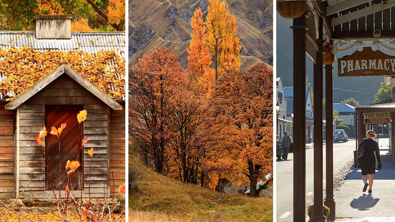
The well-formed track, which features a series of steps and sturdy wooden staircases up the steepest parts, takes hikers through lush mountain beech forest with friendly fantails/piwakawaka and tomtits/mirimiro as companions. We also spotted bellbirds flitting through the trees and were amazed at the volume they produced for their diminutive size. Their song was so piercingly sharp and sweet, it brought tears to my eyes thinking of the vicious predators that attack our endangered native birds and their eggs. It was heartening to see a few stoats and ferrets had met their demise in the traps at the side of the track.
Tantalising glimpses of the waterfall and bright shards of sunshine penetrating the pale green leaves of the beech trees made the steep climb seem effortless.
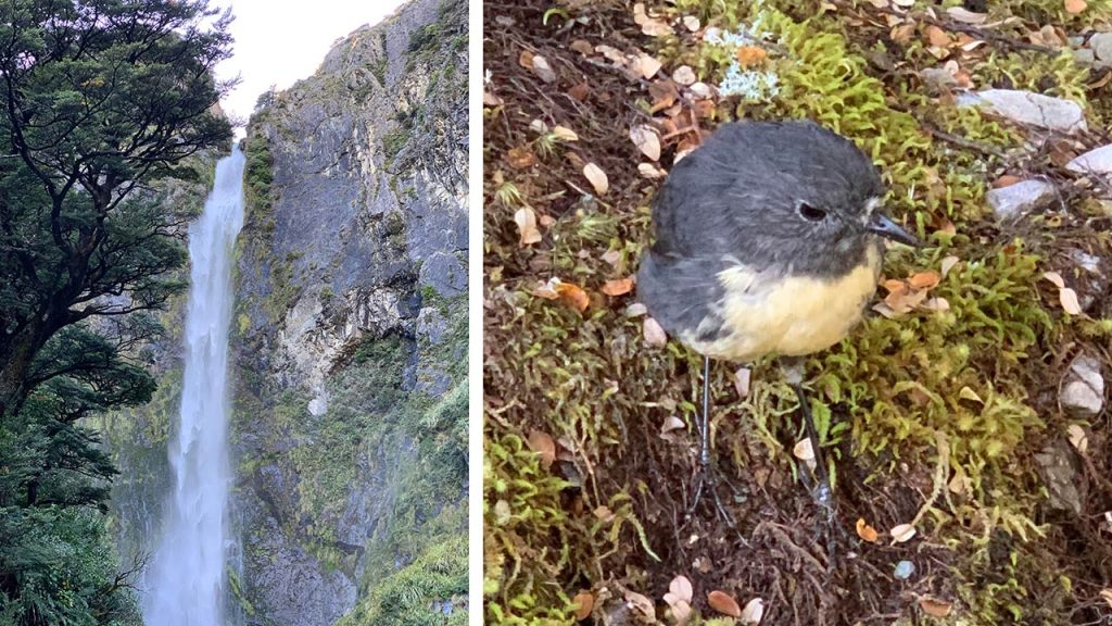
The spectacular 131m waterfall roars through a narrow cleft in the rock to the punchbowl below; Native birds entertained us with their sweet songs as we hiked up the track to the waterfall.
The track ends at an elevated viewing platform at the foot of the spectacular 131m waterfall which roars through a narrow cleft in the rock, tumbling down a wall of dark rock in a several tiers to the punchbowl below, before cascading on down the mountainside. The punchbowl itself is hidden by a mass of boulders, and, tempting though it is, we did not risk clambering across the wet rocks to view the pool.
The early morning sun transformed fine spray from the waterfall into myriad rainbow fragments. Far from devilish as the name suggests, the scene was magical and enchanted.
An information board at the viewing platform tells the beautiful story behind the Maori name for the falls. Ngai Tahu, the kaitiaki or caretakers of the land, named the falls Te Tautea o Hinekakai, Weaving Waters, after their ancestress Hinekakai, a famous weaver:
‘Maori associated natural features in the landscape with ancestors or their actions. Their stories linked the people to the landscape and reflected the inseparable ties between the natural and human world. To Ngai Tahu, these long intertwining threads of white water resembled the threads of dressed flax – whitau or muka – used to weave fine garments and mats. The falls were named for an ancestress, Hinekakai, a famous weaver. She was the wife of Turakautahi, a son of Tuahuriri and the principal Ngai Tahu chief of his time, who established the Ngai Tahu stronghold at Kaiapoi.’
I far prefer the Maori name – more mellifluous and meaningful.
We were so early, we had the platform to ourselves so were able to commune with nature and the waterfall, in peace and solitude, without the risk of being clonked on the head by a cluster of selfie sticks.
We visited on a pristine, sunny autumn day but to experience the full drama of the waterfall, the third highest in the Arthur’s Pass National Park, go there after recent rain when the cascade is thunderous, or in mid-winter when the mountain beech forest is dressed in white, the air dances with silver filaments of frost and the margins of the waterfall are frozen like stalactite sculptures.
Add on walks to the pretty Bridal Veil Falls and Bealey Chasm where the Bealey River squeezes through a narrow gap between huge boulders. On a clear day, continue on for spectacular views of Mt Rolleston.
Stop at the Arthur’s Pass Visitor Centre to learn more about hikes in the region. The visitor centre houses a restored Cobb & Co coach that used to run from Springfield to Kumara in the 1890s, and photographs that tell the fascinating history of the construction of the Otira Gorge road and viaduct.
We’ve travelled the Otira Gorge to the West Coast a number of times but the sight of the graceful curving viaduct and the construction of the road hanging off the side of the cliff always astounds me.
We were travelling in our off-road caravan so we stayed the night at DOC’s Klondyke campsite, a superb spot right on the banks of the Waimakariri River. Fending off the sandflies with tropical-strength insect repellent, we dined outside at sunset and debated at length where to hike or bike next day. So much choice, so much freedom when you’re towing a self contained, off-road ‘apartment’ behind your ute.