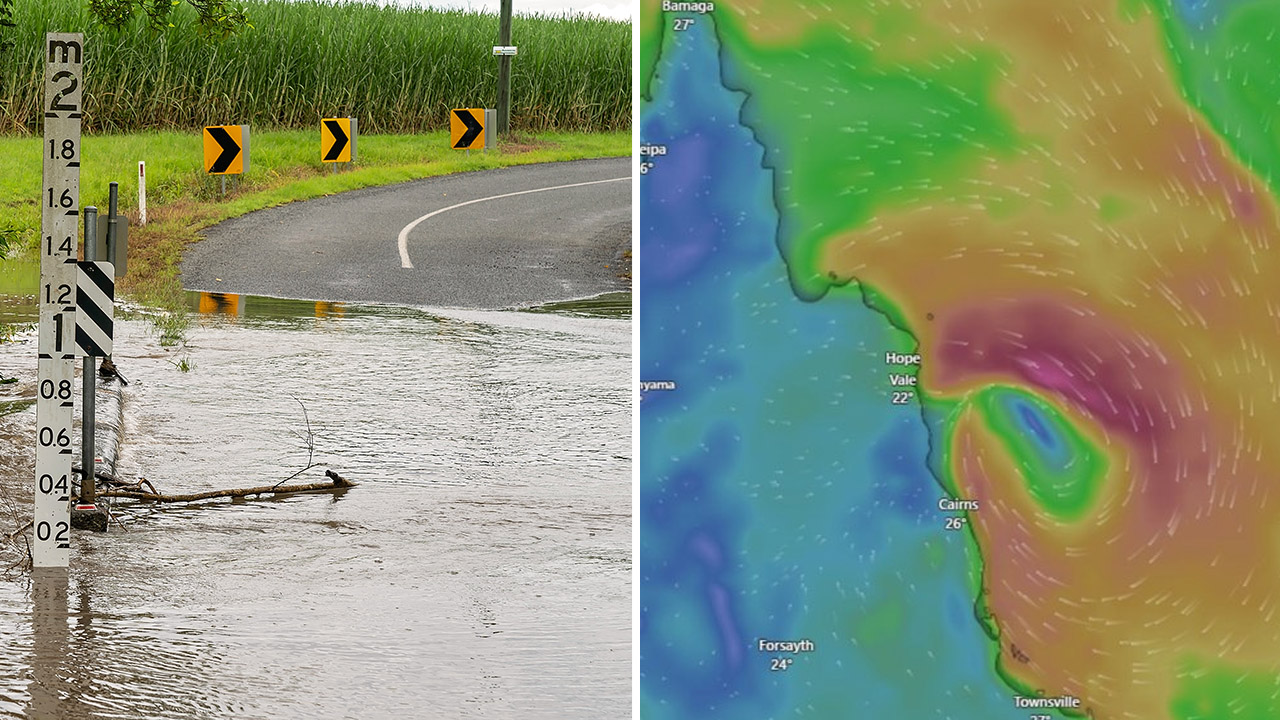
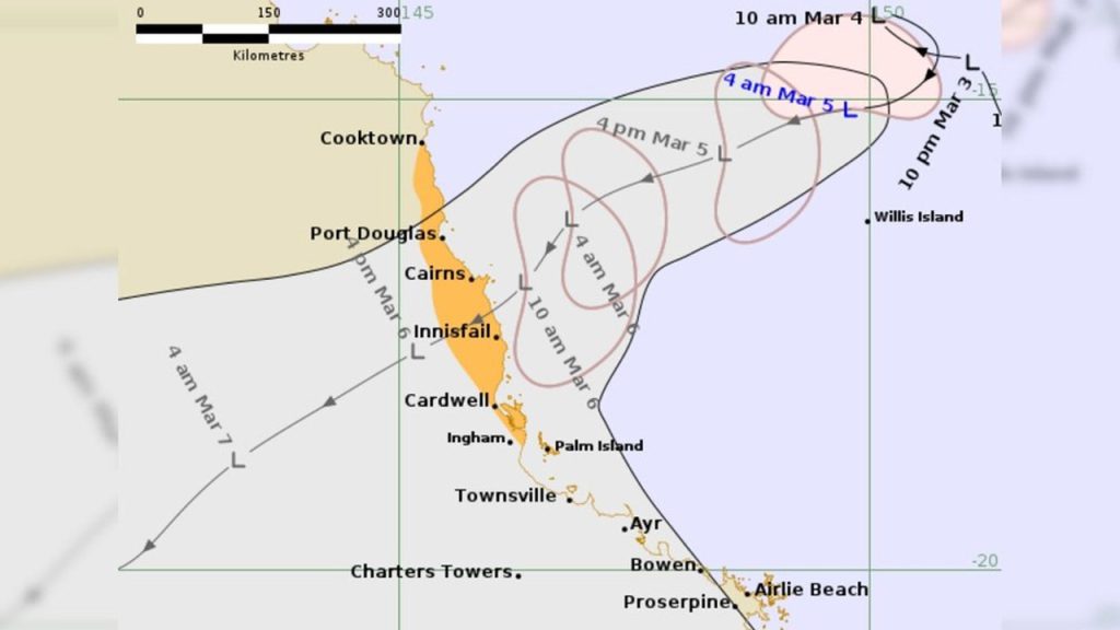
Parts of Far North Queensland are being warned to brace for heavy rainfall and potential flooding as a low pressure system off the coast of Cairns threatens to develop into a tropical cyclone as early as Friday. The system, known as tropical low 29U, is sitting about 400km northeast of Cairns in the Coral Sea and is expected to move toward the coast, with landfall forecast around the Innisfail area within the next 24 hours.
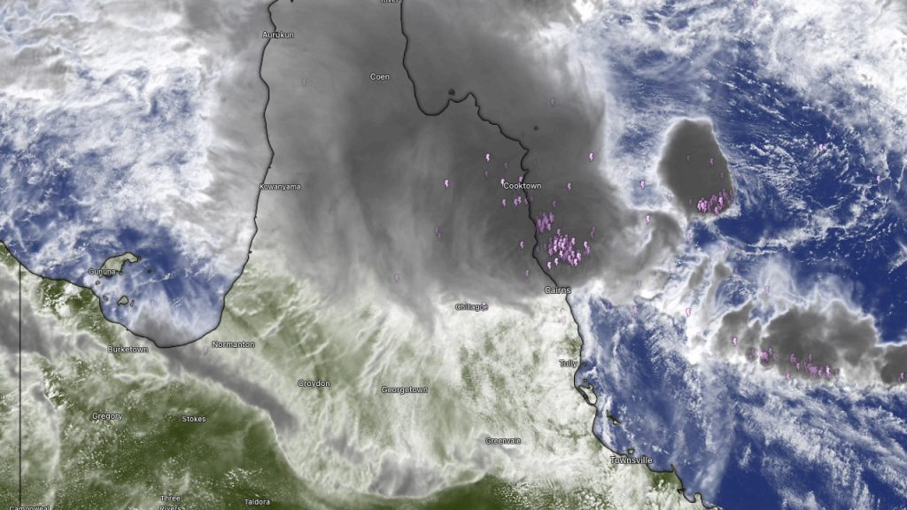
Senior meteorologist Jonathan How said severe weather could begin building from Friday morning. “We are already seeing rain and storms building to the of Daintree and up towards Cooktown, and at this stage it still does have a moderate chance of becoming a tropical cyclone today and into tomorrow,” he said.
Communities along the coast are being urged to stay alert. “We still do have a tropical cyclone watch current for communities between Cooktown to Palm Island, and this includes Port Douglas, Cairns, Innisfail and Palm Island itself.”
Even if the system does not intensify into a named cyclone, residents could still experience conditions similar to a category one system, including heavy rain and damaging winds. If it does develop into a tropical cyclone, it would likely be named Narelle or Owen.
Rain is expected to build from Thursday afternoon into the evening across the northeast tropical coast as the system edges closer, including around Cairns and areas further south. “We are expecting gale force winds to develop across the coast from early Friday morning and then extend through that cyclone watch area,” How said.

The main concern is the combination of wind, intense rain and tide impacts as the system crosses the coast. “We’ll also expect to see heavy rainfall as that system crosses the coast on Friday and this is likely to produce flash flooding as well as higher than normal tides which could exceed the highest tide of the year.”
The wet weather could spread well beyond the Far North, with heavy rain forecast to extend as far south as Mackay and Rockhampton on Saturday. By Sunday, moderate to heavy falls could affect eastern parts of the state before shifting toward central and south-eastern Queensland, with the Wide Bay and Brisbane areas also potentially in line depending on how the system tracks.
While conditions may begin to improve in northern parts of the state later in the weekend and early next week, the flood risk may linger. “Conditions do gradually ease up for northern Queensland later on the weekend and early next week but we are reminding residents that flooding issues could persist for quite some time and this heavy rainfall coming up could prolong existing flooding across the region,” How said.