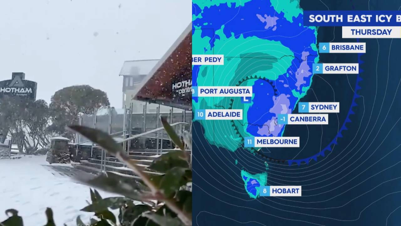
A polar blast set to hit the NSW Northern Tablelands and possibly parts of Queensland is coming sooner than expected.
South-east Australia had their own freezing weather, and it looks like QLD may experience their biggest dumping of snow in years.
Forecasters have predicted the Australian Alps could bask in a metre of snow or more over the coming days.
Canberra may also get a slight dusting.
Queensland-based Bureau of Meteorology lead meteorologist Matthew Bass said the Sunshine State could receive snowfall as early as Wednesday afternoon.
The coldest burst of air may arrive on Thursday however, with snow down to 900 metres on the Granite Belt.
Snow started falling in the Aussie Alps on Tuesday and plenty more is on the way in the coming days! Some areas are likely to see more than one metre of fresh snow this week. pic.twitter.com/0Ncg3gdY3G
— Weatherzone (@weatherzone) June 8, 2021
This means Wallangara, Giraween National Park and Eukey could see a flurry of snow.
“I think it probably is shaping up to be the biggest snow event since 2015 based on our records here,” he said.
Stephen Stefanac, meteorologist with the Bureau of Meteorology in Sydney, believes 20 centimetres of snow in the Northern Tablelands could be seen by the end of the week.
He estimates a further 50cm to a metre in the Snowy Mountains by the end of the week.

“I can’t remember recent times where we’d expect that much snow up there (Northern Tablelands),” he said.
“It doesn’t happen every year that far north.”
Mr Stefanac said there was a chance of snow in the hills around Canberra but nothing is guaranteed.
“There’s a slight risk. I wouldn’t rule it out completely,” he said.
Image: Nine News